King Tides
By Capt. Weatherly
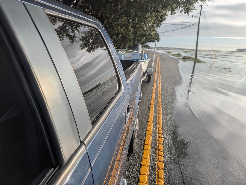
A few mornings ago I left for work, windows down, enjoying the chill in the air. The road winds directly next to the marsh and the last few weeks the sunrise has been perfectly timed with driving out to take my children to school. As I came around the curve along the marsh, ready to enjoy the view, the road abruptly disappeared. The tide was so high the road was several inches underwater with ripples pushing into the yards across the street.
King Tides.
You don’t have to spend much time in the Charleston area to figure out that we flood. Downtown is infamous for folks kayaking down the streets during a heavy rainstorm, but many places just need an extra high tide. Many roads on Folly also flood during big tides (looking at you 9th St W, aka the road to our wonderful home base at Sunset Cay Marina).
So why does this happen? Buckle up, this is an oceanography article! Our area has semi-diurnal tides, meaning we experience two high tides and two low tides each day. The average difference between high and low tide is about 5.5 feet, BUT that range can vary dramatically. Some days the water level rises only 4ish feet between tides, while others it can climb nearly seven! This morning’s predicted tides ranged from -0.08 to 6.9 feet! Are you dizzy from numbers yet? I am and we still haven’t gotten to why this happens!
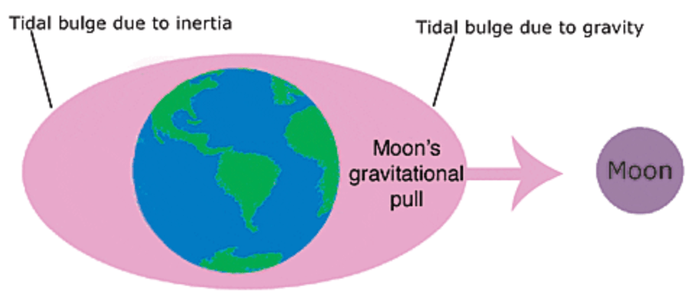
The tide is predominantly driven by the moon. The moon’s gravity has a stronger pull on the side closest to the moon and weakest on the opposite. These differences create two tidal bulges. Imagine the Earth surrounded by an ocean shaped like an oval. That’s a weird thing to imagine, so look at the picture. 🙂 As the Earth rotates, land masses pass through the bulges, creating the rise and fall of tides. Youtube has some great videos if you’re so inclined to go beyond this very simplified model.
Ok, we know why tides happen, but the variation! During a full and new moon, the sun, moon, and Earth are aligned. This exerts a greater gravitation pull on the water, giving us a larger tidal range (Spring Tide). During a quarter moon phase the sun and moon are at a right angle to the Earth and the gravitation pulls are offset so tides are smaller (Neap Tide). This is why full/new moon high tides are more prone to flooding – and exposing sandbars and mudflats you don’t always see back in the estuary.
When the moon is at the closest point in its elliptical orbit around the Earth (called perigee which is just a fun word to say), it has the strongest possible gravitational pull on the ocean. Add a full or new moon and we can experience exceptional high tides, also called King Tides! Weather conditions such as strong onshore winds or storms can also raise water levels beyond predictions.
Want to learn more? The SC Aquarium has posted signs around the island with instructions for how to take a picture and submit it during a flooding event. NOAA has a fun interactive website to visualize all this. Next time you see a road disappear into the water, think about the moon and what’s happening above us. And if you find yourself driving through any sunny day puddles, be sure to rinse your car thoroughly!